30 September 2018

Newfoundland

We only spent 9 nights on Newfoundland, but the days were so packed with interest that this is a long post, and not fully complete.

To get the ferry from Blanc-Sablon we got up very early (for us) and drove down to the ticket office to be in the queue when the doors opened. That would be 2½ hours before the departure at 8:00am. That's Newfoundland time. The ferry is a Newfoundland concern. Don't let the fact that Blanc-Sablon is in Quebec and it was only 6:30 by local clocks confuse you.

Promptly at 8:15 the doors were opened and the queuers were admitted to a lobby. Actual sales of tickets doesn't start until 2 hours before sailing, so it was 8:30 (Newfoundland time – are you paying attention?) before we were given our number in the ticket queue and could sit in the waiting room.

Of course, all this drama doesn't apply if you have a reservation, but since we seldom know where we will be for the night until 5 or 6 o'clock in the evening, we went on standby. In fact, this late in the year (it was 4 September) there is seldom difficulty in getting on a sailing, and no latecomers were turned away. We were almost the last vehicle loaded on and there was clearly space for more.

Waiting for embarkation at the front of lane 8. But lane 8 was the last to be loaded.

The loading was so efficient that the vessel left EARLY, and docked in St. Barbe, Newfoundland similarly ahead of schedule. It was an uneventful crossing over a placid sea, devoid of the much advertised whales and icebergs.

Arriving in St. Barbe.

We headed North, destination L'Anse aux Meadows, under a clear blue sky and buffeted by a fierce wind. A sign advertised a trail to the Thrombolites. Who are/were the Thrombolites? A famous ice-hockey team, perhaps? From the same starting point we can reach Marjorie's Bridge. We found a place to safely turn round and went back to the car park by the trail.


The Marjorie Bridge (the spelling varies) is named after Marjorie Myers née Burke, whose father and grandfather built the bridge. It's a nice bridge and was clearly a boon to the community when it was constructed, but it's not that noteworthy.

The thrombolites were much more interesting. They turned out to be structures built by micro-organisms in the inter-tidal zone. The organisms are believed to resemble very early life forms. Read about them here. The information board asserts that they also grow in Hamelin Pool, Shark Bay, Western Australia but I remember those as being called stromatolites, which are quite different. Well, a little bit different.


As we drove, we passed many woodpiles. They were out in the open, with no fences or signs. Are they privately owned or a community resource where anyone can go for winter fuel? We eventually discovered that they are indeed private property, but everyone locally knows who each pile belongs to and a de facto neighbourhood watch deters pilfering.


We arrived at L'Anse aux Meadows (it means Meadows Cove) around 4pm, just in time for all but the first 5 minutes of a guided tour. “Of what?”, you may be asking yourself. Of the site of the earliest European settlement in North America. Around 500 years before Columbus, according to Norse sagas, Lief Erikson colonised “Vinland”. And there is compelling evidence. Several buildings have been excavated, built in the same style as the early Norse settlements in Greenland. And a couple of them have been used as the basis for complete buildings, erected in the Norse style of 1000 AD and using the materials that were available locally at that time.

What is left of an original building.

A modern reconstruction of a Norse longhouse.

It was fascinating. The archaeological evidence is limited, but it is astonishingly consistent with the sagas, with what is known about the Norse settlements in Iceland and Greenland at that time, and with the location of a very large beach mentioned in the sagas and identified with one near Cartwright, in Labrador.

“Vinland” was a puzzle, because it apparently means “Wine Land”. But even this has an explanation. The site revealed pieces of butternut tree (a species of walnut) that nowadays grows only as far North as New Brunswick, just as the wild grapes do. So either the climate of 1000 AD permitted these plants to grow at the Northern tip of Newfoundland, or the colonists travelled further South to procure them.

Temporarily sated with history, we were returning to the visitor centre when we saw a moose and her well grown calf. They browsed unconcernedly while we enjoyed the sensation of positively seeing Canada's signature ungulate. The normally reliable Canon camera only focussed one of the pictures properly, but one is enough.

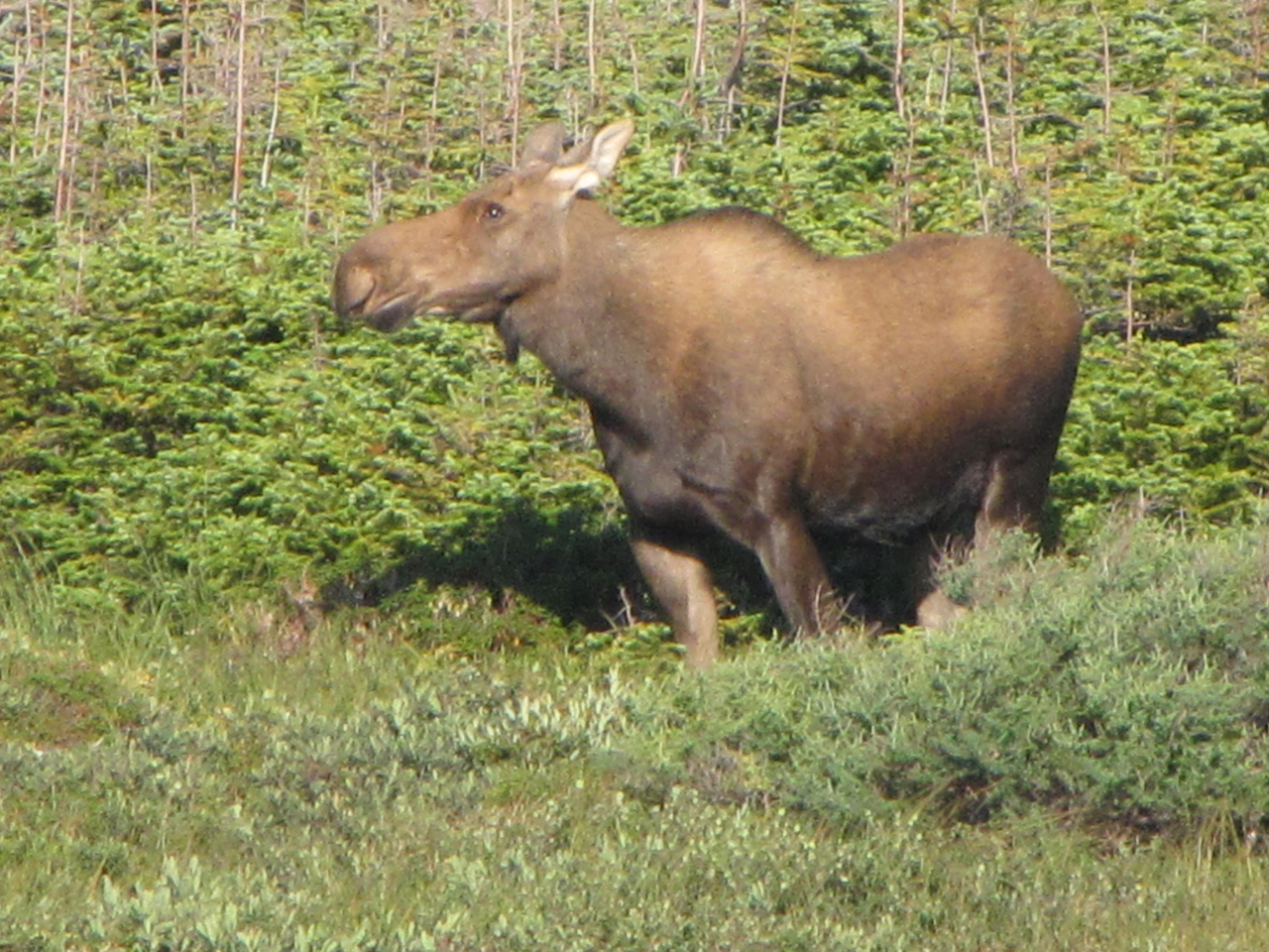
The proof that we have seen a moose.

To celebrate such an eventful and successful first day in Newfoundland we treated ourselves to a restaurant dinner. The special of the day was local produce; pan-fried cod. Delicious.

The fierce winds continued through our second day. The sun was shining, which was nice, but driving a long, high-sided vehicle was not easy. For two nights is a row our campsite app led us to free lakeside sites, but both were accessed over difficult terrain. Gull Pond wasn't too bad, but the road to Three Mile Lake was terribly potholed and we swayed violently from side to side.

As well as woodpiles beside the road, there were gardens. These were always fenced, sometimes covered in netting and almost exclusively planted with vegetables. The nearest house might be miles away. Eve figured it out. The Newfoundland soil is generally thin and would not be easy to cultivate. Road building churns up a lot of earth and rock and the debris by the side of the road could be soft and deep; easy to dig and able to yield a good crop. The fences and nets are to deter furred and feathered thieves. We later found the explanation at an information centre and she was 100% correct.

A healthy crop of potatoes.

The weather changed on the third day. It rained heavily. At first there was no wind to speak of, but then the gales returned. Yuk.

A horrible weather day.

We thought we would take a break at Table Point Ecological Reserve. It was known to Google Maps, right by the highway, but there was no sign of it in the indicated spot. No signs, no tracks, no places to park so no break. Further along the road the Arches Provincial Park did exist and provided a rest area. We walked through the rain to the beach and photographed the natural arches through which the sea foamed.


At least the rain eased as we approached Deer Lake. The urge for a proper shower was on us again, and the information centre there helped us find a campground. To get there we had to drive several kilometres along the Trans-Canada Highway, which is the main arterial road on the island. We encountered a pedestrian on the carriageway – another moose. There are many signs warning the motorist to be “moose aware” and here was the reason. A collision with a moose can be fatal to the humans as well as the quadruped. Because they are such tall animals, in a head-on collision the body of the moose can go through the windscreen of the vehicle. In this instance a couple of cars swerved and the moose cantered back into the forest with an offended expression.

Burnt Berry Resort was a motel with what looks like a newly made campground. The site was OK. The solitary shower was in the main motel building and not available to campers in the morning. But it had hot water and we got clean, which was the main thing. The couple operating this establishment were true Newfoundlanders. The wife's accent was so strong we struggled to understand her. What sounded like “aunters” translated as “hunters”. She assured us that Newfoundlanders always dropped their aitches.

We were heading for the East coast and the seabird colonies. We did stop a few times, and the trails in Terra Nova National Park were worth exploring more thoroughly. And Newfoundland's elemental weather let up, thank goodness, and we had some lovely, sunny days without excessive winds.

From a lookout in Terra Nova NP

This Spruce Grouse seemed quite unafraid.

From a trail in Terra Nova NP.

A beach by a lake in the late afternoon.

Nearing St. Johns the GPS really behaved weirdly, and took us along narrow roads that didn't seem to even lead to our destination. Eventually we discovered the reason. Long ago, in Quebec, we had selected a route that avoided motorways. We thought this was an instruction that applied only to that journey, but the wretched machine had remembered it. Most of the Trans-Canada Highway in Newfoundland was OK, but it classified some sections as “motorway” and avoided them.

In Bay Bulls we were directed through a narrow gateway to the local information centre. Bill was driving very slowly, but there was an unwelcome 'scrunch'. A concrete block was tall enough to scrape the side of the motor home. There was a scratch on the cabin door, and some of the aluminium framing was distorted. Damn! We removed the twisted piece along the bottom of the door and it was at least able to close without catching anything.

The puffins breed in the Witless Bay Ecological Reserve. We found a great campsite by the beach in Witless Bay, had a little walk and photographed some shore birds. No puffins, though, so we booked a boat trip for the next morning.


This is a semipalmated plover. If you look carefully you can see the half-webbed toes that give it its name.

It was a Saturday night. For some people that means party night. Unfortunately the 'some' included the occupants of the house nearest to our campsite. It was a still night so the sound carried very effectively and went on until past 1:30am.

The boat tour must be counted a success, even though we were at least a month too late for the best birding and even though the tour operator decided we would like the commentary suspended so that he could fill the boat with Newfoundland-Irish music. (In fairness, it wasn't too bad and one of the crew, with a very good voice, sang a couple of songs.)

There were free drinks for any tourist that spotted a whale spouting. Although a couple of claims were lodged I suspect that it was just foam on the waves. There were no definite sightings of big whales. A few white-sided dolphins were confirmed, but they were quite a long way off.

Another company's boat had located a sunfish and our skipper took us very close. They are an odd fish, since they can barely swim fast enough to catch the jellyfish they eat.


This one spent the entire time on its side. Is that their normal orientation? Anyway, it was flopping around at an all-you-can-eat buffet and was presumably happy.

The skipper did not seem to be in any hurry to get to Gull Island, where the puffins breed, but there were a fair few of them around us; some sitting in the water but most flying fast in one direction or another.

Warning: Bill took over 500 photographs that day. Many have been erased as not worth keeping, but there are an awful lot on the laptop's hard drive. Only a very small sample are included here. Maybe we will put up another post with more bird pictures for the naturalists among you to enjoy.

The island is a major breeding location for puffins, murres and razorbills. The murres had raised their chicks and had departed. So had all but one of the razorbills. And that individual evaded the camera. The puffins we were seeing were the late breeders whose pufflings were not yet ready to fly. Puffins only have one chick per year, by the way. So all we could see much of were puffins and those that prey on them – gulls and eagles.

The gulls will certainly take chicks if they can, but more often they harry a puffin carrying fish back to the nest burrow, make the puffin drop its cargo and steal the fish. The bald eagles take a more direct approach.

The very first picture of a puffin.  This one has a beak full of capelin, the small fish that must exist in teeming millions to support all the birds and whales that prey on it.

Another puffin.

Taking off requires a running start.

A puffin dives:- Head down; kick with the feet; gone.

A young (Herring?) Gull in flight.

A bald eagle who didn't wash his/her face after breakfast.

An immature bald eagle with its lunch. There was a chorus of “Oooh” when it was determined that lunch was a puffin, but that's the natural world.

A young seal put in an appearance.

The next birding location was Cape St. Mary's. Birds breed on islands only just offshore where they can conveniently be photographed. It was almost dusk when we got there. A large, flat gravel parking lot had no prohibition on overnight parking so we stayed. It was light enough for a look round. Almost immediately Eve spotted a bird on the ground. We had a clear look through the binoculars and even got a photo. A boldly striped face and yellow markings. It should be easy to identify from the field guide.

There was a distant noise – as of thousands of seabirds. And there they were, not so very far away. So we took the cameras and followed the path.

Gannets were circling, landing, greeting their mates and offspring, arguing with neighbours and generally carrying on. Thousands of them. The smell of so many fish-eating birds and their guano made itself felt. There were so many subjects for the Nikon camera and Tamron telephoto lens it was hard to choose.

In the morning the light was, of course, from roughly the opposite direction and stronger, so we gazed at the rowdy, milling throng and took lots more photographs.

A young gannet flexes its wings while the adults are (mostly) preening.

A gannet in flight near sunset.

A gannet in flight in the morning

The parent bird is regurgitating fish for the chick's breakfast. The chick's beak is as long as its parent's and it's all inside!

We noticed that the gannet colony had outgrown the island and had started nesting on the mainland cliffs as well. The same is true of the gannets at Muriwai in New Zealand. But there are a lot more gannets at Cape St. Mary's.

The information centre was open after we returned from our morning excursion. The lady was most helpful. There are more species that breed at the Cape, but they have already finished and only the gannets are left this late in the year. Of the land birds we had correctly identified Savannah Sparrows. “And there are lots of Horned Larks.” We had not identified last night's 'easy' bird so we looked up the Horned Lark. Sure enough, that was what it was. And before you laugh too heartily at our failure to identify it for ourselves, the species has a whole page of the field guide to itself with 14 illustrations of plumages sported by different subspecies and/or at different times of the year.


Yes, it does have the markings of a “Northern Horned Lark – winter plumage”, but not nearly so tidily as the drawing in the book.

Our final days in Newfoundland involved a lot of driving and a day trip to France. They will be the subject of a separate post.

17 September 2018

Inuvik

Here is the oft-postponed description of the Aboriginal Day celebrations in Inuvik.

The Arctic is not all snow, ice and polar bears. In summer, at least, there are large areas of green and the temperatures can get above zero for weeks at a time. In fact it was very pleasantly warm while we were there. 21 degrees Celsius on 21 June, which was Aboriginal Day.

Inuvik has an open, grassed area near the centre of town. In New Zealand we would call it a “domain”. It had a large stage, and a semicircle of tiered seating. Beyond the seating were a few stalls. Food was being prepared at some of them. Members of the local juvenile population played happily on the stage.

The time advertised as the start of the festivities came and went. No-one showed any concern. About half an hour later than the official kick-off the children were asked to leave the stage and the welcoming speeches began. As we have previously reported, visitors were very warmly welcomed. In fact, the master of ceremonies asked if there was anyone from outside Canada. We put up our hands and were presented with a little bag each, containing souvenirs of Inuvik. The thermal coffee mugs, in particular, have been very useful.

In any similar event in New Zealand the stalls behind the seats would have been selling their produce, but in Inuvik the two principal food stalls were simply handing out helpings to anyone who queued up. One supplied hamburgers to the hungry, the other delivered an Arctic favourite, fish and potatoes. There was a condition attached to the fish and potatoes; you had to supply your own plate. We had plates and cutlery in our motor home, of course. The fish and potatoes were very good.

The main activity on the stage for the day was a demonstration of Arctic games. To be quite truthful, we wouldn't want to play many of these games at, say, a family picnic on the beach.


This one could be fun. The man in the blue shirt is trying to make another player laugh by imitating the sound of an animal and pulling faces. The last one to crack and grin is the winner.

Most of the games were to help the young Inuit to prepare for the rigours of traditional life in the Arctic, which requires both strength and athleticism.


A one-man-per-side scrum. The object is to push your opponent backwards.


Women played all the games, too. The referee is making sure that they have adopted the correct starting position before trying to pull. Note that the 'free' hand is holding on to the opponent's ankle. We didn't understand the significance of this, except that it is one of the rules. The contest is best of three pulls.

Going outside when the temperature is minus 40 can involve great discomfort. To get ready for this winter activity two players sit on the ground with a stick between them and push. The stick is lodged just above the chin and then, in round 2, between the upper lip and the nose. It was explained that this simulates the pains in the face that very low temperatures can generate. There was no faking. The stick bent so far it almost snapped.

We have probably all skipped rope at one time or another. The Inuit version demands a sequence of different 'jumps' that start off with the familiar body-upright-launch-with-the-feet and get progressively more difficult, ending with a push-up and, for experts only, a 'bottom' jump from a seated position.


The player is being carried across the stage holding on to the stick with his wrist, not his fingers. I don't think any competitor made it all the way across.


Girls too.

Here the objective is to hang on with your feet. The guy in the picture did hang on all the way across.


The final contest was to kick a soft ball suspended above the stage. One format is from a standing start, the other variation allows a run-up. The tricky bit is the requirement to land on one foot; the one you kicked the ball with! Everyone has a turn and then the ball is lifted higher. It starts at about head hight. The world record with a run-up is with the ball about nine feet off the ground. The local champion (pictured) has managed well over eight feet.

A really good game was the blanket-toss. Strong men were summoned from the audience because it takes a lot of co-ordinated pull to generate the upward thrust to get the player airborne.


After the games came drumming and dancing.


He wasn't a member of any official troupe, but he could dance in time to the music.

Finally there was a jigging contest. This is certainly not an old tradition. The music was distinctly Irish in style and played on a fiddle. Although it was all in fun, it was a genuine contest with several age divisions. 

Here a couple in the 11-15 years division are being judged for style.

Helium-filled balloons were popular. Some of them were very large depictions of animals or cartoon characters and they certainly added colour to the occasion. They frequently escaped and allowed the crowd to see the direction of the wind above the rooftops. So many flew off towards the troposphere that we wondered whether it was deliberate. Against that must be set the sight of parents determinedly lashing a balloon to their child's arm or buggy.

During the day we chatted with quite a few people. The locals were universally friendly and welcoming.

21 June was also the summer solstice, or longest day. The sun would not set that night for any observer North of the Arctic Circle. A summer joke in Inuvik is “I'll do it before sundown.” It is far enough North that the sun does not set for some weeks. We determined to see the midnight sun.

From Inuvik's longitude we could work out how long after midnight GMT was local, astronomical midnight. Due to the sometimes illogical Canadian time zones it was at 2:54 am by the clock. We set the alarm for 2:45 and went to sleep. Eve woke without the help of the alarm around 2:40, drew back the curtain and saw the sun low in the sky. Five minutes later clouds had obscured sol and Bill didn't see the sun. He and 2 or 3 others were prowling around the campground with cameras and cursing the weather.


It's midnight, and the sun is out there somewhere. At least it is obviously daylight and the sun's presence above the horizon can be deduced from that.

Eve's Musings

I thought it was about time that I added to our blogs of our super-trip but Bill covers our day to day travels so well. However, I've been thinking about a few things that I'd like to share with you.

First of all: Is there anything I wish we'd brought with us on our travels?
We managed to pack nearly everything we need but I do regret leaving my book of North American Wildflowers behind. On which note.......


Everywhere you go in the Canadian countryside there are lots flowers along the roadsides. Many are introduced European flowers but some are unique to the province/climate they are growing in. Who would have thought that the Yukon has its own dandelion species? They look just like the brutes that grow in our garden at home but have a different structure around the petals (I think) that make them unique. Each province has its own special wildflower, for example, the Yukon has Fireweed which is the first plant to recover and flower after the many forest fires that occur in the area. Newfoundland has a Pitcher Plant and Alberta the Wild Rose. Goldenrod is another chosen plant but I forget which province claims it as its own – it grows just about everywhere.

To change the subject entirely, now I'm going to talk about bread. When we were in Whitehorse, our friend Anne-Marie Dillon was able to get me a dried sourdough starter which I have re-constituted and use regularly to make bread. The original starter came from 1898 – yes folks – 1898! It was begun by a family in Whitehorse and carried around in various forms on hunting trips and other travels. The family have kept it going all these many years and now one of the descendants of the original family gives dried starters away. I hope I can take a dried sample back home eventually and continue its long life there. It's a particularly easy recipe and doesn't involve all the faff of other sourdoughs I've had and given up on.


Change of subject again. Accents now. O.K. You've probably heard that all Canadians use the word 'Eh' At the end of sentences. I beg to differ because I think they use the word 'Right' (pronounced “Rate”) far more as a conclusion. Also, I was surprised, though I shouldn't have been considering the size of Canada, that there are distinct regional accents. It's particularly noticeable in Labrador where the natives speak in a sort of country twang and so fast it's almost unintelligible. In Newfoundland there's a definite Irish brogue of the 'Begorrah' kind mixed in with the Canadian.


Next, Walmart. Well, we've been inside many of their shops as we often park the camper in their carparks, but so far we haven't seen any of the weirdly dressed shoppers there that you often see on YouTube clips. I bet there's a lot of folks who've been stark naked in the middle of a Walmart carpark though, considering all the people who take advantage of the store's policy that you can park there overnight.

Musings over for now folks but there will definitely be more to share with you later on in our trip.

12 September 2018

Driving to Labrador

We stayed a week with cousin Mike Theilmann and Maren in Ottawa. It would have been easy to stay there indefinitely, they were such good hosts. Every day they organised interesting things to do, and placed tempting foods in front of us. But Bill wanted to see the puffins in Newfoundland before they fly out to sea for the winter, and Eve was keen to see Labrador.

On our last day Mike cooked pancakes for breakfast, and invited his best friend and wife, Mark and Ellie (Sp?), to join us. So it was a very convivial meal that farewelled us from the capital.

It was a Sunday, so the traffic on the highways was not too bad.

Non-Canadians must understand that most folk in Quebec have French ancestry and speak French, which is an official language in Canada. In Ontario all road signs are in both languages. In the Western provinces some road signs are repeated in French. In Quebec they are only in French.

We took a break at the first tourist information office in Quebec. Bill attempted, with fair success, to ask his questions in French. The lady behind the counter followed suit, until Bill had to resort to English. The lady was, of course, completely bilingual, but was impressed that a New Zealander should speak any French at all. She loaded us up with maps and guide books.

Shortly before we arrived in Quebec City we had to drive across a bridge. A big, long, high bridge across the St Lawrence River. Bill is an acrophobe (irrational fear of heights) and drove with white knuckles and fierce concentration on the road ahead. Beyond the bridge there was a lot of switching from one highway to another. Getting into the correct lane was, of course, most important so the density of traffic instantly trebled. The GPS took this opportunity to have several fits, when it suddenly appeared to lose its location and give impossible or ridiculous directions. By the time we reached our destination for the day Bill's stress levels could only be soothed by the application of whisky.

In Quebec City RVs are allowed to stay in the car park for the former city zoo. Other vehicles may park there, too, but RVs are special. Only RVs have to pay. At least there is a dump station for wastewater, and a fresh water supply.

There is also a bus stop nearby, with a frequent service to the interesting old city; the only walled city in North America. We spent a day ambling about the old streets. We took the ferry across the river to Levis and back. We enquired about the open-top bus tour, but it was CAD 42 each, which is ridiculous.
No buses down this old street

Quebec City from the river

Another street in the old town

In a rare extravagance we lunched at a posh restaurant, the Lapin Sauté. In regular French this means Fried Rabbit, but in Quebecois we are told it means Crazy Rabbit. Fried or crazy, it specialises in serving rabbit dishes, and very good they were, too. We gave ourselves a night off from cooking as well, by carrying takeaway galettes on the bus back to the former zoo's car park.


On the Tuesday we discovered a weakness in Quebec's guide books. They tell you what the attractions are, but not how to find them. Our GPS believed it could take us to the Montmorency Falls, but its final instruction aimed us through a locked gate with an 'employees only' sign. We had to follow the road we were on for several kilometres before we could stop safely and discover that we had no way of finding the scenic wonder. At no time did we see a road sign that mentioned the Falls.

OK, we'll console ourselves with driving “The St Lawrence Route” from Baie-Saint-Paul to La Malbaie with its 58km of “breathtaking panoramas overlooking the St Lawrence River”. The main road took us to Baie-Saint-Paul easily enough and there was a road sign to La Malbaie. But we never saw a glimpse of the river. There are two roads from Baie-Saint-Paul to La Malbaie.

The twin of the ferry that took us across the Riviere Saguenay

Finding a nice, quiet campsite for the night retrieved something for the day. It was part of the Route des Baleines (Whale Trail). A path through the woods took us to a viewing platform from which we saw no whales. But it was a nice walk and we discovered lots of fungi.

The whale-watching platform - with no whales in attendance

A forest toadstool

More fungi

The forest

To get to Labrador we had to head North on Quebec's Highway 389. This road has had a bad reputation, so Transports Quebec has published a glossy little brochure (only in French) to reassure the motorist. It divides the road into 7 sections, 5 of which are sealed road. We report what we found:
  1. 22km to Manic-2, a hydro dam. Sealed, yes, but not well maintained. Very winding and slow.
  2. 192km to Manic-5, another hydro dam. Sealed and for the most part not too bad a surface. Many trucks.
  3. 175km to the site of Gagnon, a town that has completely disappeared. Gravel. “Bonne condition.” The brochure is out of date, because the gravel section is now only about 100km. The remainder has recently been sealed. The sealed section, being the newest part of the highway is very good. The gravel section starts with a horribly steep climb from the foot of the Manic-5 dam. Although the rest of it is not as challenging, the surface is variable and we would not describe its condition as “bonne”.
  4. 88km to Fire Lake. Sealed. The surface is not bad, but the estimated driving time of 1 hour 0 minutes is plain silly.
  5. 67km to Mont-Wright. Gravel. “Bonne condition.” Generally better than the first gravel section and mercifully shorter.
  6. 19km to Fermont. Sealed. OK.
  7. 35km to Labrador City. Sealed. OK, but better on the Labrador side of the provincial border.
The brochure also forgot to mention the rain.

Gasoline suppliers are scarce along the highway. The motel/gas bar/store at Manic 5 made the most of its monopoly, charging almost as much per litre as we had to pay in the Arctic in June.

At Manic-5 the road takes you directly towards the dam, and so close that we imagined that we would end up right inside. In fact it turns aside at the last moment and shortly afterwards has your engine complaining as the vehicle crawls up the steep gravel climb.

The straight-ahead bit of road is not for tourists!


The first stretch of gravel.  It quickly became steeper, narrower and much less even.

All that is left of Gagnon is a few hundred metres of road with a central reservation. It is very odd to find a divided highway (English: dual carriageway) in the wilderness. But wilderness it is. Not a stick of Gagnon town remains standing.


Fire Lake and Mont-Wright are both the sites of iron mines. On Fire Lake itself we saw a huge flotilla of ducks (species not determined), but elsewhere along the route we saw no waterfowl of any kind, despite plenty of suitable habitat. Maybe they are already heading South.

An iron mine with some of its detritus in the background

A very large, mysterious iron mining device

Labrador welcomes the motorist with a large sign and 4 flags flying. One of them is the union jack. Our first theory was that this was a snub to the Quebecois, but we learned later that the union flag has been adopted as the provincial flag of Newfoundland and Labrador, which together constitute a single Canadian province. Later, the province's francophones adopted their own flag, which we suspect was due to a lack of affection for Great Britain's standard. 

If there was an instruction at the border to advance our watches by an hour, neither of us saw it.

The grandly named Labrador City is a pleasant place, but much smaller than either Whitehorse or Yellowknife, the principal towns of the Yukon and Northwest Territories respectively. (At the time of writing we have not yet visited St. John's, the provincial capital in Newfoundland.) The tourist information office had exhausted its funding for the year and apologetically offered a rack of literature to select from. Luckily there was a lady in the building who was willing to answer our questions and give advice on places to visit. Since she was originally from Newfoundland, all of her recommendations were on the island. A particularly comprehensive booklet was available only in French. The last copy in English had been taken that morning.

Gregory was slightly overdue for an oil change. In case there were any problems we preferred to have them explained by a mechanic with English as a first language. Our French is not up to the technicalities of the possible causes of dirty oil. The local Ford dealer was willing to do the job. “Come back at 4 o'clock.” That conveniently left us time to do some shopping. But just as we were leaving the supermarket we noticed that Bill's tablet was showing the time as 4:50. Labrador is an hour ahead of Quebec! Our apologies to the service manager were waved away. “It doesn't matter. We'll do it now.” And there were no problems.

At Labrador Mall we had not only obtained goods, but permission to camp for the night. “Please park near the soccer fields or by the fence. You can plug in for your electricity if you like.” Yes, it really was a free powered site. We didn't take unfair advantage of the offer, but it was nice to give the batteries a night off.

For the sake of non-Canadians we should explain that the winters can be extremely cold here, and many vehicles in the higher latitudes have a power lead dangling from the front. These are to operate a heater that prevents the engine from freezing. In Yellowknife most parking places have a power point. At Labrador Mall they are only along the fence, and are mostly reserved for employees of mall businesses. That makes sense. Their cars will be out in the cold all day, while shoppers' vehicles will only have to tough it out for an hour or two.

At the end of August it wasn't freezing in Labrador City, but it was certainly not tropical. Eve was chilly enough to try switching on the heater. We'd tried a couple of times before and it hadn't worked, but that night it did. And it didn't use much gas, either.

It is 1,135 km from Labrador City to Blanc Sablon, where a ferry takes the explorer to Newfoundland. So we filled up with gasoline and propane (LPG), borrowed a government satellite phone against emergencies, and set off.

The first sector is the 533 km from Labrador City to Happy Valley-Goose Bay, the largest settlement in central Labrador. From the literature we had been able to gather there was only one recommended point of interest along the way. Surely there must be more to see than that?

Perhaps it is because the supply of lakes and scenery generally is so lavish in Labrador that the tourist authority doesn't bother to mention it. Especially in the first half of the journey, there were lakes of all shapes and sizes. All of them were attractive, but there was not a single rest area where the weary motorist could sip a cup of tea and contemplate the beauty. Nor, oddly, did there seem to be places for fishermen to park their cars and launch their boats. This is very strange because Labrador is famous for the quality of its angling. There arefolk with access to the water, because some of the lakes have private properties on the shore. But not many. We concluded that those planning to fish their way around Canada would have to enquire with the vendors of angling materials to obtain information about actually reaching the water.

Waterfowl were there none. Not a duck, goose, grebe or coot was to be seen on all those acres of lake. A few gulls on the coast were the closest Labrador could get.

The highway to Happy Valley-Goose Bay, Highway 500, has only recently been completely paved, which may explain the lack of rest areas. In fact, when we found one about 20km before Churchill Falls we were so surprised we stopped there. It was large and smoothly tarred, with a gravelled area that led down towards the river. Intending to admire the Churchill River we drove downhill. It was too far back from the river bank to see anything worthwhile, but what is this? A sign. It says “Bowdoin Canyon Nature Trail”.

In the Trans Labrador Highway Guide there are four “MUST SEES” along Highway 500, and Bowdoin Canyon is #1. Its location is given in the guide as “just outside of Churchill Falls”, which is not how we'd describe the 23km that Google Maps calculates is the distance from the rest area to the settlement of Churchill Falls. There is NO mention on the highway of Bowdoin Canyon, even though it is apparently the most desirable sight in 533km. 

We set off along the trail, of course. It took us through forest and every now and then to a roped-off spot where the trail overlooked the river. We could see a canyon from the 2nd or 3rd lookout, and it wasn't that impressive. But it was by now clear that the river disappeared over a lip and there must be quite a sizeable waterfall over the edge. It took us nearly half an hour to get to a point where we could see the cascade, and it was worth seeing. The trail continued, and may have provided an even better view further on.

A picturesque lake along the trail

Labradorean flowers

Our best view of the falls. The picture doesn't show how impressive they really are

More fungi!

Churchill Falls is the only settlement between Labrador City and Happy Valley-Goose Bay. Gregory has a range of at least 600km on a full fuel tank, but we stopped to top up anyway. The town looks like a very large work camp, and that is precisely what it is. All but 3 properties are owned by the power company that runs the hydro power station, which is the town's only industry. #2 of the guide's must sees is a tour of the underground power plant. No thank you. Despite the gas station's extremely powerful position as the only supplier for 500km, the price was only a few cents more than we'd paid in Labrador City.


#3 must see was a sudden, marked change in the vegetation. We did see it, and it was indeed notable. (#4 was Mud Lake, a historic village accessible only by boat. We think that over-stretches “along Highway 500” and we didn't look for the ferry.)

The Trans Labrador Highway used to have a reputation as a horrible drive over ghastly roads. Hwy 500 is now a very easy and pleasant journey. Just set cruise control to 80kph (we think the road could easily permit a higher speed limit), sit back and steer.

A typical stretch of Highway 500

We arrived in Happy Valley-Goose Bay mid-morning on a Saturday. The Visitor Information Centre in Happy Valley is closed at weekends, and would also be closed on the coming Monday as it was a public holiday. Next we tried the library for Internet access. Closed – with no information about when it would be open. Any wi-fi was apparently switched off. How about the laundromat? Open! Hooray, we can continue to wear clean clothes.

On the advice of the guide we made a side-trip to North West River, which is in fact a small town. The interpretation centre provided interesting information about the various first nations groups in the area. The Metis are the offspring of Europeans who settled and married native women. They are accorded the same recognition as the other nations. 

After we went round the exhibits, the lady at the desk offered us a lesson in berry picking. Around the car park she showed us wild blueberries, redberries (not yet ripe), crackerberries and a tiny white berry that is also edible but requires a heap of effort to collect even a handful. She invited us to help ourselves to whatever we could find in the surrounding woods. We managed a small bowlful of blueberries and a few crackerberries to garnish our morning cereal.

The Wiki Camps app promised us a campsite off the road between North West River and Goose Bay. It was very difficult to find since there are no signs and Google Maps has the access road in the wrong place. It directed us to drive over a ditch and into a stand of trees! However, we did eventually find the campsite at Gosling Lake's beach. The long weekend, which marked the end of the school holidays, had brought out many local families, well supplied with wood for their campfires. There were even a few fireworks. The prime sites at the back of the beach have power points and, except for Regatta weekend, there is no charge for the use of the park.
The less favoured sites in a huge open rectangular space. That's us on the left.

The water off the beach was very shallow and apparently safe for swimming.

It would have been an extra adventure to take a ride on the supply boat that visits the settlements along the North Labrador Coast. There are no roads to Natuashish and Nain, but the round trip takes 5 days and we are already at risk of arriving too late to see the puffins in Newfoundland.

Highway 510, which connects to the Atlantic coast of Labrador, is not as appealing as Hwy 500. It is sealed for only part of its length and, shortly after you set off you are warned that the next gasoline is 392km away. Since you must have driven at least 11km from a gas station to reach the start of the highway that makes more than 400km with no access to fuel. That even beats anything we encountered in Australia. There are no must sees on this highway until you get to the historic places on the Atlantic coast.

The sealed section at the Western end of the highway is OK, but the gravel road is very variable. The worst sections are badly potholed. There are many fewer lakes. However, there was a pleasant surprise when the gravel section ended earlier than shown on the map. The worthy Labradoreans are even now extending the seal westwards from Port Hope Simpson.

Much of Highway 510 looks like this

We had to advance our watches another half hour. At least this was clearly notified by a large sign alongside the highway.

The trip to Battle Harbour is a several hours excursion with a distressingly high price tag, so we declined to go. Instead we read the many information boards at Mary's Harbour. I wondered what soldierly heroics had given the historic harbour its name, but it turns out it is a corruption of its earlier French name, Bateau Havre.

All aboard for Battle Harbour.  The vessel looks nice but costs too much.

We'd been really looking forward to the drive down the Atlantic coast, but we saw very little. The mist came down and at times it was so thick and the visibility so bad we had to crawl along. At least we didn't hit anything, and it thinned enough to find the place where we returned our borrowed 'phone.

"Cafe in the Mist"  It was just the day to have hot soup for lunch.

The ferry to Newfoundland leaves from Blanc Sablon, which is actually in Quebec in a time zone 90 minutes behind this part of Labrador. But the ferry is run by a Newfoundland operator and it uses only Newfoundland time. So we left our watches as they were. We established when we had to report to the ferry terminal on the morrow and repaired to a delightful little campground, Parc Goodchild. Thank you Blanc Sablon municipality for a first-class, complimentary facility.

Plastic chairs and a fire pit made for a pleasant break.

02 September 2018

Where do we stay while on the road?

Campground fees can sometimes be as much as an Airbnb. If we are going to be living in our RV for a year that really adds up. And what is the point of being self-contained if we don't take advantage of it?

There were 18 nights between staying with Lynne and David Tullis in Osoyoos and parking in Mike and Maren Theilmann's neighbour's driveway in Ottawa. They were:
  • 1 mechanic's yard
  • 5 roadside parking places
  • 3 official campgrounds
  • 1 village street
  • 4 Walmart parking lots
  • 1 wildlife refuge
  • 2 truck stops
  • 1 suburban railway station

The mechanic's yard was because we suddenly lost the ability to indicate turns. We left the highway at the next town and searched for a repairer. The first place we asked could not help, but they gave us 2 'phone numbers. The first of those invited us to park in their yard (it was now after 5pm) and they would investigate in the morning. We actually had neighbours. Another RV was parked in the yard, waiting on the delivery of some parts. In the morning our electrical problem was found to be a loose connection. It was tightened and we were on our way again.

Roadside parking places are sometimes identified from a great app called Wiki Camps, sometimes from other Internet sources, and sometimes we just find one. If we do, we add it to Wiki Camps. The locations range from gravelled parking areas beside a historic notice to rest areas with toilets, picnic tables and rubbish bins. Unfortunately, most rest areas forbid overnight camping. It's weird. We can pull in at breakfast time, cook meals, use the toilets and have a sleep, but have to move on in the evening. If they are worried about people living there permanently why not limit stays to 24 hours?
Approaching Waterton Lakes Park we were invited to pull off the road and enjoy the view.  We did so - and stayed the night.

There was a significant railroad event nearby, "Last Spike at Feist Lake". We suppose that this is Feist Lake.

 
A rest area beside Lake Superior that did allow overnight parking.  Lovely.

This nice large, level space is for followers of a Lake Superior water trail to launch their canoes. Heaps of spare space for a motor home to park.  The little hut in the background was originally a toilet, but is now full of rubbish and not fit to use.

The official campgrounds were:
  • a village campground that charged $10 to park on their grass and provided a small ablution block with toilets and showers. Sites with a power supply and/or water cost more.
  • a village campground that advertised a tariff of $20 for a site with power. We offered $5 just to park (there were no toilets or showers), and when the custodian learned that we were from New Zealand he let us stay gratis. What a nice man.
  • a town campground run by the local Lions Club. The only available sites had a power supply, but the charge was a modest $20. The location was very pleasant, by a river, and the ablution facilities were excellent. They also had a dump station where we could empty our waste water tanks.
The Lions Club campground in Neepawa from across the river.

The village street was a last resort. Wiki Camps showed a campground, but it looked to us like private property, so we parked outside an empty building where we would not bother anyone and stayed the night.

Walmart, either because the directors are RVers themselves, or because they reckon it's good for business, usually allow overnight parking. This has the bonus of a store right on hand for food and almost anything else we might want, and sometimes there is Wi-Fi in the parking lot. However, Walmart doesn't always own the parking lot and some landlords forbid overnight parking. Some local authorities won't allow it either. The Walmarts around Quebec City used to allow overnight parking, but it's now against the law. :-(

We arrived at the Oak Hammock Marsh wildlife refuge late in the afternoon, after the shop had closed. But the trails through the marsh were still open, so we did some wildlife viewing. There were no contrary signs in the car park, so we stayed put and walked another trail in the morning.

Truck stops are not ideal, but they are free. Trucks can noisily arrive or depart at any any hour of the day or night, and many of them leave the engine idling, presumably to keep the air conditioning going while the driver sleeps. One of these two had great showers for $7 each, and the cheapest laundry in Canada – only $1 to wash and $1 to dry.

The suburban railway station was the suggestion of an Ontario Tourist Office employee. We wanted to see some friends in Toronto, but there was nowhere to park near their apartment. “GO Transit stations have huge parking lots and you can get the train into downtown Toronto.” The principle was sound, but unfortunately we picked a station with a small and very crowded parking lot. Fitting our mobile home into even two regular spaces at 6pm was a challenge. We met our friends and their little boy, had an enjoyable meal and took the train back to Port Credit, where Gregory was now in luxurious acres of empty space. Five minutes later a transit policeman arrived. Someone was concerned that we were not bona fide users of the parking lot and a tow truck had been ordered! Luckily the special constable was kind and constructive. We had used the train, so we were legal. Sleeping in the parking lot was not a problem so long as we didn't get in the way of the morning commuters. He left his card, and the 'phone number of the Transit Safety and Security Office, which could direct us to a more appropriate station if we wanted to visit Toronto again. We got up extremely early the next morning and were on the road at 6am.