There's a lot to see along this route, through Mississippi, Georgia and the Carolinas. We aimed to follow scenic routes where possible, and found a lot of history pretty much by accident.
Traffic was heavy and driving uncomfortable through New Orleans, but once we were over the Mississippi River and on the interstate highway the stress levels dropped to normal.

A Mockingbird that sat unconcernedly in a bush so close that Eve could photograph it with the little Lumix camera.

What a great name. So good there are four Coffeevilles. This refers to the Alabama one.
We spent a night in Selma AL. Much has happened in the area. There were major civil rights marches from Selma to Montgomery in 1965, but we didn't follow the Voting Rights Trail. We did go to Old Cahawba, Alabama's first permanent state capital and now a ghost town.

The largest remaining building.

The preserved wooden building.

A green lizard in Old Cahawba

A nearby brown lizard.

The Perine Well. An artesian well, it was drilled to serve a factory, but the factory was never built. At least one historian has reported that, when dug, it was the deepest well in the world. The information board gives the current depth as 700-900 feet.

There were many of these American Beautyberries in the town.

Fort Toulouse, near Wetumpka AL (what a great-sounding name) was a disappointment. There were no information boards at all. And it was raining.
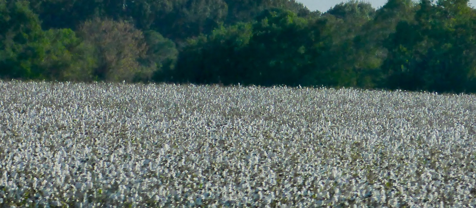
Cotton is still a significant crop in the South.

Modern bales of cotton.

A cotton field after harvesting.
The bolls are much thicker in this field, so we conclude that the harvesting had not yet been done.
The Little River Canyon was a very worthwhile destination.

The Falls

The river from the top of the canyon

Canyon walls
We spent the night after Little River at the DeSoto State Park Campground. For a state park it was expensive, but at least we did get a hot shower.
We went to look at the DeSoto Falls in the morning.

The first drop here is over a weir, apparently built to make the higher part of the river suitable for boating. The natural cascades are not the DeSoto Falls, but a little way upstream. We found the head of the main falls, but the falling water was out of sight. It was cold and wet and the ground was slippery so we elected not to risk broken necks to see the actual waterfall.

Russell Cave National Monument. The cave itself isn't terribly spectacular, but the story of the excavations and the information they revealed are available in the visitor centre. It was used for thousands of years as a shelter by cultures of prehistoric Indians, from approximately 6500 BCE. Fascinating.
In Marietta, near Atlanta, Georgia, we visited another of Bill's father's contacts in the International Water Lily Society. We spent a very pleasant day with Shirley Covington and her son, David. As well as feeding and generally entertaining us they had thoughtfully agreed with the neighbours that we could park in the street overnight. Thank you.

David and Shirley Covington.
Advice from various sources agreed that we would be well advised to avoid the main highways around Atlanta. Luckily our next destination was the Etowah Mounds, which were easy to approach on minor roads.
Bill, particularly, had been intrigued by the mounds we saw on the Natchez Trace, and Etowah was mentioned as one of the more important sites. Home to several thousand Native Americans from 1000 A.D. to 1550 A.D., this 54-acre site protects six earthen mounds, a plaza, village site, borrow pits and defensive ditch. Etowah Mounds is the most intact Mississippian Culture site in the Southeast.

Mound C photographed from the top of Mound A (if we've remembered correctly).

An Eastern Bluebird at Etowah.

We pulled off the road for a cup of tea and found a roadside statue crawling with ladybirds (or ladybugs, if you prefer the expression). A few members of the swarm found their way into Gregory's cab and travelled with us for several miles.

You never know what you might find batting its eyelashes at you in a Walmart parking lot.

A nice waterfall in the Chattahoochee-Oconee National Forests, near Blairsville, GA.

Georgia spellin'

It must mean something different in Hiawassee, Georgia.
Highway 64 in North Carolina from Franklin to Highlands turned out to be another memorable drive. It's not nearly as long as the Natchez Trace Parkway. It's also much narrower and busier. In fact it was so popular on the day we drove it (19 November) that there was insufficient room for us to pull off the road at most of the beauty spots. We had to keep driving past wonderful waterfalls and other scenic gems.

We did manage to stop at the Bridal Veil Falls. Note that the road used to go behind the waterfall.

From behind the chute.
We spotted a rest area near Sunset SC just at cup-of-tea time. A short walk to stretch our legs led to a very picturesque stream.


Our route towards Asheville meant that visiting the site of the Cowpens battle was only a short detour. This was the site of a significant battle in the American Revolutionary War. Brigadier General Daniel Morgan commanding the Continental Army (i.e. the Americans) won a decisive victory over British Lieutenant Colonel Banastre Tarleton. There is considerable debate over the numbers of soldiers participating on the American side, but the battle was won due to General Morgan's very superior tactics, not weight of numbers. And the loss of Tarleton's force contributed in large measure to the ultimate defeat of the British.
The information centre has an excellent re-enactment video, based on a militiaman's account of the action, that gives a very clear picture of how the battle was conducted.

The 'gun' is a metal silhouette. It gives a good idea of the size of the field artillery employed in the battle.

It is an easy walk around the site, with helpful information boards. We were surprised at how small the area was and how close the opposing armies were. Even with firearms as standard weapons a soldier could see his enemies very clearly.
No comments:
Post a Comment